Establishment is a process to observe, not a conclusion obtained from one green photograph. Build a record that distinguishes intended vegetation, other plants, exposed ground and changes in condition. Use representative locations and written project criteria, with the appropriate person interpreting the evidence. The portal tool can compare entered observations with entered thresholds and estimate inspection effort. It cannot establish sampling validity, identify species, judge rooting or issue a site acceptance.
Agree on what is being reviewed
Identify whether the visit concerns application delivery, emerging plants, later vegetation condition or an erosion-control obligation. Those purposes can require different observations and different qualifications. Record the criteria and the authority that governs them. A homeowner's preference, a contract milestone and an approved construction requirement should not be merged into one unexplained pass label.
Ask the responsible adviser how terms such as cover, uniformity and established will be defined for the project. Does cover mean the intended live vegetation only, or something broader? How are overlapping plants, dead material and carrier products handled? Set the measurement convention before comparing numbers so successive visits and different observers are examining the same thing.
Select representative locations deliberately
Map locations across contrasting zones, including areas that appear strong and weak. Use identifiers that can be found again. The Alberta Forage Manual discusses checking multiple locations and stand uniformity in agricultural evaluation. Its particular agricultural density values should not become universal lawn thresholds. The broader lesson is to avoid assessing a variable site from one convenient spot.
Ask a qualified person to define the sampling design when a formal project decision depends on it. The number entered in a workload calculator is not proof of statistical representativeness. Record how locations were chosen, what part of the site they represent and any areas that could not be safely inspected. A limitation disclosed early is easier to interpret than an apparently complete report with hidden gaps.
Pair close observations with overview photographs
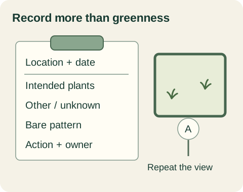
Use fixed overview points to show broad pattern and close observations to record the ground condition. Include a scale and location reference where appropriate. Repeat the direction and framing as consistently as practical. Photographs can reveal change but do not automatically quantify cover or distinguish similar species; identify where specialist interpretation or measurements are needed.
Do not photograph only the most attractive area or rely solely on a distant green view. Capture thin edges, shaded strips, low pockets and other mapped differences. Keep the original dates and a simple file naming convention. A shared folder or report should connect each image to the relevant zone and visit rather than leaving reviewers to guess which corner it depicts.
Record composition separately from total cover
Distinguish intended plants from unwanted or unidentified vegetation. Alberta's range-health framework considers ecological function and diversity beyond overall greenness. That is especially relevant where the goal is native recovery or another specified community. A high total cover estimate can be misleading if much of it is a competing plant rather than the intended vegetation.
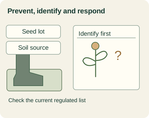
If an observer cannot identify a plant, mark it as unknown and request the appropriate identification. Do not silently count it as acceptable grass. Preserve close images and its mapped location. The follow-up action should be documented, including who supplied the identification and whether the project plan changed. A useful field record leaves room for uncertainty instead of forcing every observation into a positive result.
| Record separately | Why it matters | Follow-up |
|---|---|---|
| Intended live vegetation | Connects observation with the objective | Use agreed cover method |
| Unknown or unwanted plants | Total greenness can conceal composition | Obtain identification |
| Connected bare patches | Pattern differs from average cover | Map and measure under project method |
| Rooting and traffic condition | Not measured by cover arithmetic | Responsible manual review |
| Runoff or damaged protection | Can need action despite favourable cover | Report under applicable plan |
Measure bare areas in a way that preserves pattern
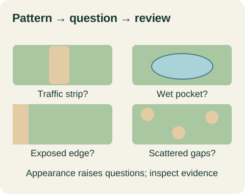
Total bare area and the largest connected bare patch describe different features. A series of tiny dispersed gaps is not the same arrangement as one continuous exposed strip, even if their total area matches. Record the project's definition and method for a patch measurement. Link observations to a map so a later repair scope can identify where intervention might be needed.
The tool compares your entered largest patch with your entered allowance and cover with your entered target. It reports numerical gaps only. A patch below the selected allowance can still require review because of its location, flow pathway or other condition. The model should never combine those two comparisons into an unconditional statement that the whole site is established or safe.
Keep events and actions in the timeline
Add application dates, weather observations, watering changes, traffic, maintenance and repairs alongside the field visits. Record whether information is measured, reported by someone else or inferred. When a change in vegetation follows an event, the timeline supplies a hypothesis to investigate; it does not prove causation merely because the dates are adjacent.
Assign each issue to a responsible person and record the response. A report should indicate whether the issue is being monitored, assessed, repaired or escalated. For construction ESC work, use the applicable inspection requirements and qualified personnel; the City describes routine and critical-event duties. A homeowner's observation notebook supplements rather than replaces a required formal inspection record.
Budget the effort without prescribing the frequency
Enter the planned number of locations, visits, minutes at each location and travel time per visit. The model multiplies those assumptions to show field time and total effort. Those are editable scheduling inputs, not a recommended inspection standard. Add time for reporting, specialist review or other tasks outside the simple arithmetic when preparing the actual work arrangement.
For a hypothetical plan with five locations, three visits, five minutes per location and ten minutes travel per visit, observation time is 75 minutes and travel adds 30, for 105 minutes total. Extra event-based visits can change that total. Confirm the required visit process with the project specification and responsible adviser before using a convenient workload estimate as a committed scope.
Use the records to support a review conversation
Imagine two visits showing higher intended cover overall but one connected bare strip that has expanded. The owner supplies the same-point images, measurements and event timeline. The responsible reviewer can investigate that strip even if an average appears favourable. The tool's numerical comparison remains attached as one piece of information, with its assumptions visible.
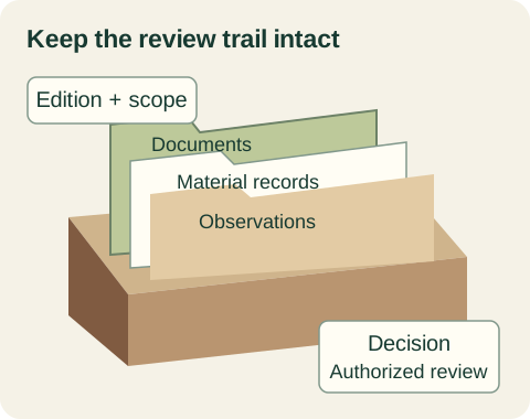
Keep the decision, required action and next review date in the same record. If a criterion is met, describe precisely which observation met which entered criterion; do not broaden it into a certification the reviewer did not issue. A repeatable record makes progress and concerns discussable while preserving the distinction between arithmetic, field evidence and authorized acceptance.
Sources + further reading
- City of Calgary: ESC authorizations
- Government of Alberta: Range health
- Government of Alberta: Alberta Forage Manual
Source review: 2026-10-04. Requirements and programs can change; confirm the current details with the authority or provider.